
Elkhart ZIP Directory Coverage
Four USPS designations serve the Elkhart postal city. The current USPS labeling list groups 46514-46515 under the Elkhart 46514 sorting destination and 46516-46517 under Elkhart 46516. That routing fact does not establish block boundaries. Use the USPS ZIP Lookup with a complete address for the delivery answer.
| ZIP | Official coverage wording | Postal reference | Boundary caution |
|---|---|---|---|
| 46514 | Elkhart delivery area | Elkhart 46514 sorting group | Resolve exact streets through USPS; no official polygon was located. |
| 46515 | Elkhart delivery area | Grouped with Elkhart 46514 | A distinct ZIP designation, not a separate municipality. |
| 46516 | Elkhart delivery area | Principal Elkhart Post Office listing | Postal reach can extend beyond incorporated limits. |
| 46517 | Elkhart delivery area | Grouped with Elkhart 46516 | No public station-by-station delivery map was found. |
The Elkhart Post Office detail uses 46516-9998. That is a post-office listing, not proof that 46516 alone defines central Elkhart or that another local ZIP belongs to one named neighborhood. Research found no official PO-box-only or unique institutional ZIP for Elkhart, so none should be inferred.
Older USPS lists placed all four designations under the Elkhart sorting destination, while the current labeling source divides them into two paired groups. That is a routing presentation, not evidence of a dated ZIP split. The research found no official year-specific realignment record. Describe the current grouping with its access date and avoid assigning a historical cause that USPS did not publish.
The official post-office page shown below gives the postal anchor for this Elkhart ZIP code directory.
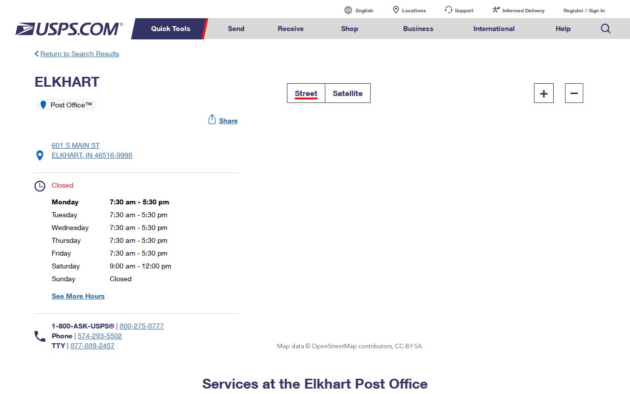
Use its current office listing as a contact point while relying on the address lookup for a specific delivery code.
Search Elkhart Postal Fields
USPS provides three distinct search modes. Choose the one that matches the question. An address search resolves delivery for one place. A city-and-state search returns the ZIP Codes associated with Elkhart, while a ZIP search returns the city names tied to one code. None is a public resident list.
| USPS mode | Fields supplied | Best use |
|---|---|---|
| By Address | Company, street, apartment or suite, city, state, ZIP | Confirm one full delivery address and ZIP+4 |
| By City and State | City and state | List ZIP designations associated with Elkhart |
| By ZIP | Five-digit ZIP | Return associated city names |
A result may show postal convention rather than incorporated jurisdiction. Save the standardized address and access date, then move to parcel and city records for geographic proof.
Apartment or suite details matter because the address mode includes a secondary-unit field. A city-and-state result is broader and may list codes without telling which one serves a given house. The reverse ZIP mode answers yet another question: which city names are associated with the code. Choose the right mode rather than treating the three screens as interchangeable.
Narrow Elkhart Searches by ZIP
A ZIP Code Directory can define a search area, but Elkhart's main resident-related sources do not all accept ZIP input. The assessor instructions expose owner, address, and parcel-number searches, not a promised ZIP filter. Indiana Voters uses a person's name, date of birth, and county. INBiz business search and the Indiana professional-license search do include city and ZIP controls, yet those results describe an entity or credential, not who lives at an address.
- Enter the full street address in USPS ZIP Lookup. Save the standardized address, five-digit code, and ZIP+4 if returned.
- Open the Elkhart County Beacon map and search that address. Compare the parcel's situs address with its separate mailing address.
- Check the city annexation table when postal Elkhart and municipal status may differ. Keep the parcel number and legal description as stable keys.
- Use a ZIP field only in a portal that documents it. Label a business or license result for what it is, not as residence proof.
- After narrowing to one named street, use the Elkhart street directory workflow for address-level property and historical sources.
The Indiana voter status tool is useful only when the searcher already has the required personal fields. A separate VRG-24 request governs county voter-data access and carries restrictions and redactions. Do not turn a postal code into a list of households or assume a ZIP-wide search identifies current residents.
When a portal returns a name, keep the source and field labels with it. A license page may carry a business address, and a parcel card may show an owner's mailing address apart from the property situs. Matching the same ZIP across those fields does not prove they refer to one home. Compare the full address and record date before linking them.
Note: A ZIP narrows delivery geography; a parcel, dated directory entry, or other official record is needed to connect a name with a place.
Elkhart ZIP Geography in Context
City and county figures must stay separate. Census QuickFacts reports 53,923 people in Elkhart city in 2020 and an estimate of 54,092 for 2025. The city covers 27.49 square miles in the displayed period. Elkhart County is a larger unit whose seat is Goshen. None of those totals can be divided into reliable ZIP resident counts from the sources found.
The county statistics page provides that larger context.
Its county estimates should not be presented as city or ZIP-level counts.
Neighborhood labels add a third layer. Downtown, River District, Benham, Sterling East, Pierre Moran, and association areas describe planning or community geography, not postal fields. The city's neighborhood plans help explain those place names.

The plans supply local context, but their boundaries must not be substituted for a USPS delivery result.
Elkhart Portals with ZIP Fields
ZIP input means different things across state systems. The INBiz public business search offers entity name, business ID, agent, address, and advanced filters that include city and ZIP. The Indiana license verification search includes profession, name, license, DBA, status, city, county, and ZIP Code fields. Those portals can confirm a filing or credential associated with an address line.
Beacon is the stronger route for a parcel. Its documented search choices are owner, address, and parcel number, and the assessor guide says the parcel number must include 20. Indiana Voters is keyed by county rather than postal code. This difference prevents the common mistake of treating every database with a city or ZIP box as an occupancy roll.
Elkhart ZIPs and City Limits
A mailing city can remain Elkhart even when a parcel lies outside the incorporated boundary. A newly annexed parcel may also keep familiar postal wording. Elkhart's annexation table tracks boundary changes from 1927 through 2024, including recent additions east of Vernon Avenue and north of Greenleaf Boulevard, Elkhart East Annexation Phase 1, and land at 2400 South Sixth Street. USPS routing does not redraw itself to serve as a municipal map.
- ZIP and ZIP+4
- A ZIP is a five-digit delivery designation. ZIP+4 adds a smaller delivery segment, but neither is a parcel boundary.
- PO-box ZIP
- A code used for post-office boxes. Research did not identify an Elkhart code that should be labeled PO-box-only.
- Unique ZIP
- A designation assigned to one high-volume organization. No official unique Elkhart ZIP was located.
- Carrier route
- A set of delivery points assigned to a postal carrier. It can change and is not the same as a neighborhood.
Run the exact address through USPS, Beacon, and the city annexation code. If the results differ, state each result separately. The safe claim is that four USPS designations serve postal Elkhart, not that four fixed neighborhood zones divide the city.
Historical Elkhart ZIP Address Trails
Older Elkhart sources may predate the current ZIP wording or use a former street. The city code records Lincoln becoming South Second in 1887, Vistula becoming East Jackson in 1889, duplicate-name changes in 1909, and later renamings through the 1990s. Rural delivery routes, additions, townships, and publisher abbreviations can also replace a modern postal line.
Start with the historical edition and its own abbreviation key. Crosswalk the street through the code table, use a Sanborn map for the building and nearby landmarks, then compare the current parcel's legal description. The legal description often provides continuity when a house number, street name, city label, or ZIP Code changes.
A city directory street section can then place a dated occupant at the old address. It is not a current resident roll. Preserve the directory year and page, USPS access date, parcel number, and annexation ordinance so another researcher can reproduce the path.
What Elkhart ZIP Codes Prove
An Elkhart ZIP code directory proves postal association only to the extent of its current USPS source. It cannot establish that a person occupies a house, that every address lies inside city limits, or that a planning district equals a postal zone. No official ZIP polygon, station delivery map, per-ZIP population table, registration table, or dated realignment history was located in the research.
Use the narrowest valid claim. USPS verifies delivery. Beacon identifies a parcel and separates situs from mailing fields. The Recorder documents legal instruments. The annexation code tracks municipal change. A dated directory or census can show historical residence, subject to its own limits. Keeping those roles separate makes a ZIP code directory useful without asking postal geography to prove more than it can.
Note: Recheck USPS and portal fields before publication because routing, interfaces, status fields, and access terms can change.